RF Terrain Profiles app for iPhone and iPad
Developer: INGENIERIA TELEMATICA MURCIANA SOFTWARE SL
First release : 17 Dec 2014
App size: 23.1 Mb
RF Terrain Profiles is a useful tool for planning radio links (WiFi, DTV, ...) over terrain.
The main features are:
- SITES. You can create a single or multiple sites over terrain. Also, you can import KML files generated in Google Earth or export KML files to be used in Google Earth.
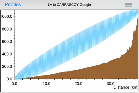
- REPRESENTATION of terrain profiles and First Fresnel Zone between two geographical points. You can see immediately if the First Fresnel Zone is obstructed or not by the terrain and the percentage of the First Fresnel Zone clear of any obstructions is automatically calculated. Also, the Free Space Path Loss is calculated.
- OPTIMIZATION of the frequency and antenna heights in the sites for a given First Fresnel Zone clearance. Very useful to find automaticaly the antenna height needed to satisfy some visibility conditions.
- ORIENTATION of the antennas in azimuth (relative to the North) and elevation (relative to the horizon) between two geographical points. Useful for quickly orientating the antennas situated at the sites. A COMPASS is included to facilitate the orientation.
- LINK BUDGETS. The Link budget calculations can be done to determine the maximum allowed path loss, taking into account the equipment configuration elements and parameters (transmitting power, cable loss, antenna gains, sensitivity, etc.)
- AVAILABILTY: The availabity (%) is automatically calculated in the geographical area where the radiolink is located, following the UIT-R recommendations (UIT-R P.837, UIT-R P.530 y UIT-R P.676).
- DATABASE. Sites, Profiles and Link Budgets are store in a SQLite file that can be easily managed from other apps or programs for example to be exported to other formats (CSV, ...)
- DROPBOX. You can store the database (sites, profiles, Link budeget, ...) in a SQLite file and share them (if you want) instantly with your RF Terrain Profiles user group.
- DIGITAL TERRAIN MODEL.
You can calculate profiles, without an additional cost, using data provided by GOOGLE with 500 points per profile from a Digital Terrain Model (DTM) with a resolution of 90x90m.


